RANDONNEE DU SENTIER DES TROIS TOURS

Pedestrian

Difficulty

Very Easy

Distance

5,0 km

Duration

01h40

Height difference

160 m

Municipality of departure

FAUGERES

Municipality of arrival

FAUGERES

ITILAR034V50GFW9_1 © ADT34

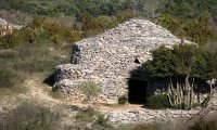
From Faugères, a protestant stronghold during the wars of religion, the path rises until you come to the windmills (a vast panoramic view of the plain and the mountains) and crosses a garrigue dotted with dry-stone huts and dry-stone walls.

Altimetric profile

Address

GPS coordinates : 43.5650030 / 3.19081558

Contact

Your consent
This site uses cookies (or tracers) when you browse. Your explicit consent is required for their use. Click here to find out more
This site and related services may place cookies * (or trackers) on your computer.
They are not installed by default.

Online video distribution platforms (Youtube, Vimeo, Dailymotion, etc.) may place cookies intended for statistical and marketing monitoring of your consultations. Refer to their respective privacy policies for more information.
The refusal of these cookies will not affect their consultation on the current site.

This site is subject to audience measurement via the Google Analytics platform. See the Google Analytics privacy policy for more information.
Refusing these cookies will not affect your user experience on the current site.

Social networks (Facebook, Twitter, Instagram, Trip Advisor, etc.) may deposit cookies intended for statistical and marketing monitoring of your link sharing. Refer to their respective privacy policies for more information.
The refusal of these cookies will not affect your visit to the current site, but will prevent you from sharing the content of this site on your respective networks.

* a cookie is a small file stored by a server in the terminal (computer, telephone, etc.) of a user and associated with a web domain (i.e. in most cases to all the pages of 'same website). This file is automatically returned on subsequent contacts with the same domain.