RANDONNÉE CABREROLLES LE PIC DE LA COQUILLADE
Pedestrian
ATTENTION - WORKS (information October 2023)
An alternative itinerary has been set up from the start of the route (Cabrerolles cemetery) to "Camp Boutat" via the Passa Meridia / Grande Traversée de l'Hérault. Alternative route from "Camp Boutat" to Pic de la coquillade: stay on the trail. Follow the deviation signs.
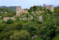
At the start of this itinerary, the village of Cabrerolles reveals its built heritage, with its 12th-century château and chapel dedicated to Notre-Dame-de-la-Roque. Along the paths and tracks, sheltered by evergreen oaks, discover the Biterrois plain, the Orb valley and the Caroux plateau, which spread out before you in a mosaic of landscapes and colors.
Altimetric profile
Address
GPS coordinates : 43.5444463 / 3.12512842
Contact
- Fixed telephone : +33 4 67 36 67 13
- Website (URL)


