RANDONNÉE AUTIGNAC LOS CAUQUILHATS VARIANTE COURTE
Pedestrian
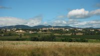
This path winds through the hills sown with garrigues and
and vineyards. A peaceful softness is revealed in the mosaic landscapes of this wine-growing
of this wine-growing territory? Treading these paths today is to walk in the centuries-old footsteps of the inhabitants of Autignac, ?los cauquilhats? !
Altimetric profile
Address
GPS coordinates : 43.495300 / 3.167605
Contact
- Fixed telephone : +33 4 67 36 67 13
- Website (URL)


